Pristine Seas Expedition: Arqvilliit
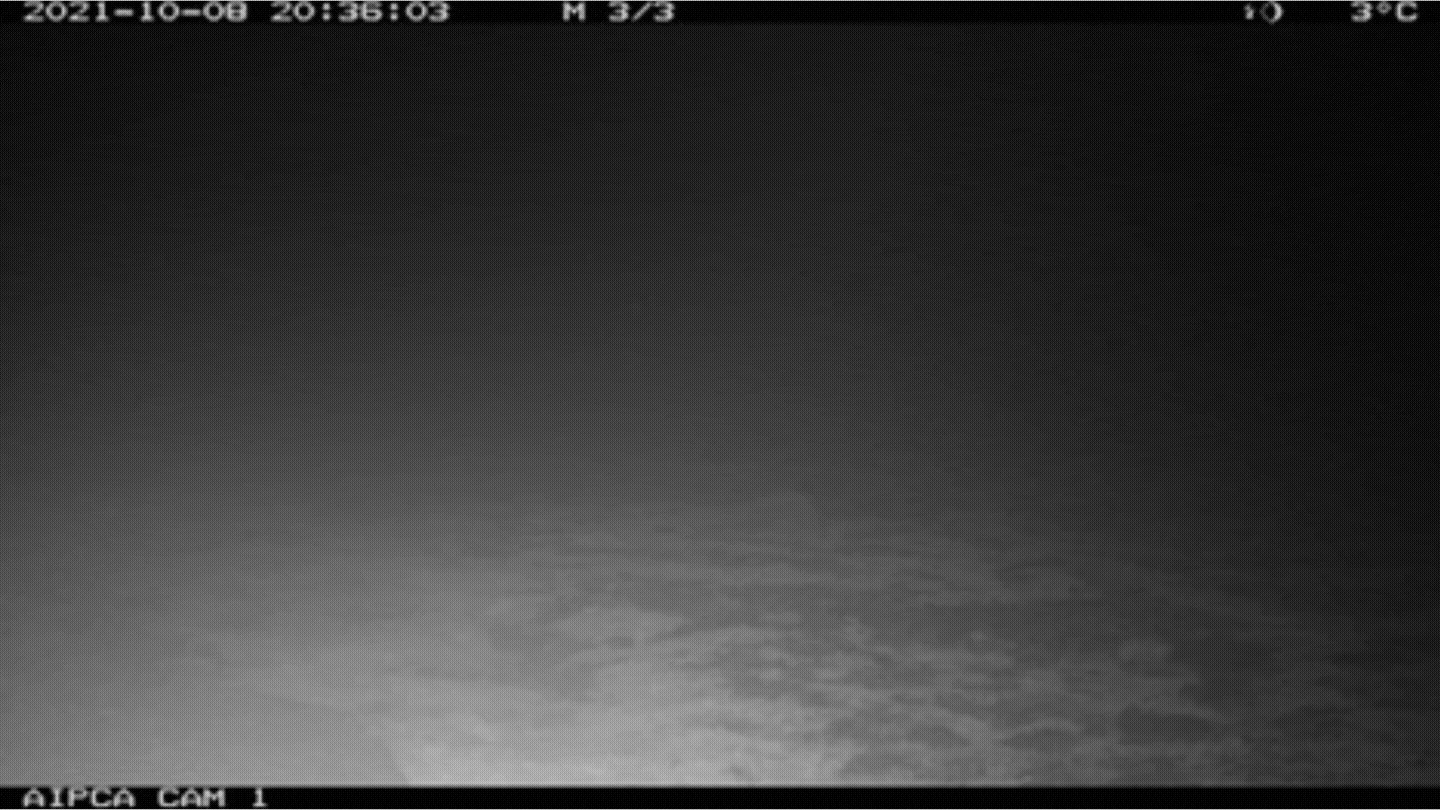
In the first photo, all you can see is pitch darkness, except for a fuzzy white line at the bottom of the frame. Then the white fuzz gets bigger—and rounder. Finally, the picture resolves into a plump polar bear investigating something on the ground; then suddenly, there are two bears!
Credit: Arqvilliit IPCA Monitoring Crew.
Nunavik Inuit have lived and harvested in this region since time immemorial, and now they are working to protect it through the establishment of an Indigenous Protected and Conserved Area (IPCA). The Arqvilliit IPCA team is led by Inuit leaders from the Northern Village of Inukjuak, the Anguvigak Local Nunavimmi Umajulirijiit Katutjiqatigiinninga (LNUK) and members of the public, as well as staff members of Oceans North. Gathering more data and raising awareness is a critical part of establishing a new protected area, and the Arqvilliit IPCA team was excited to partner with the Pristine Seas expedition, which has been contributing to Indigenous-led conservation projects across Nunatsiavut, Hudson Bay and James Bay.
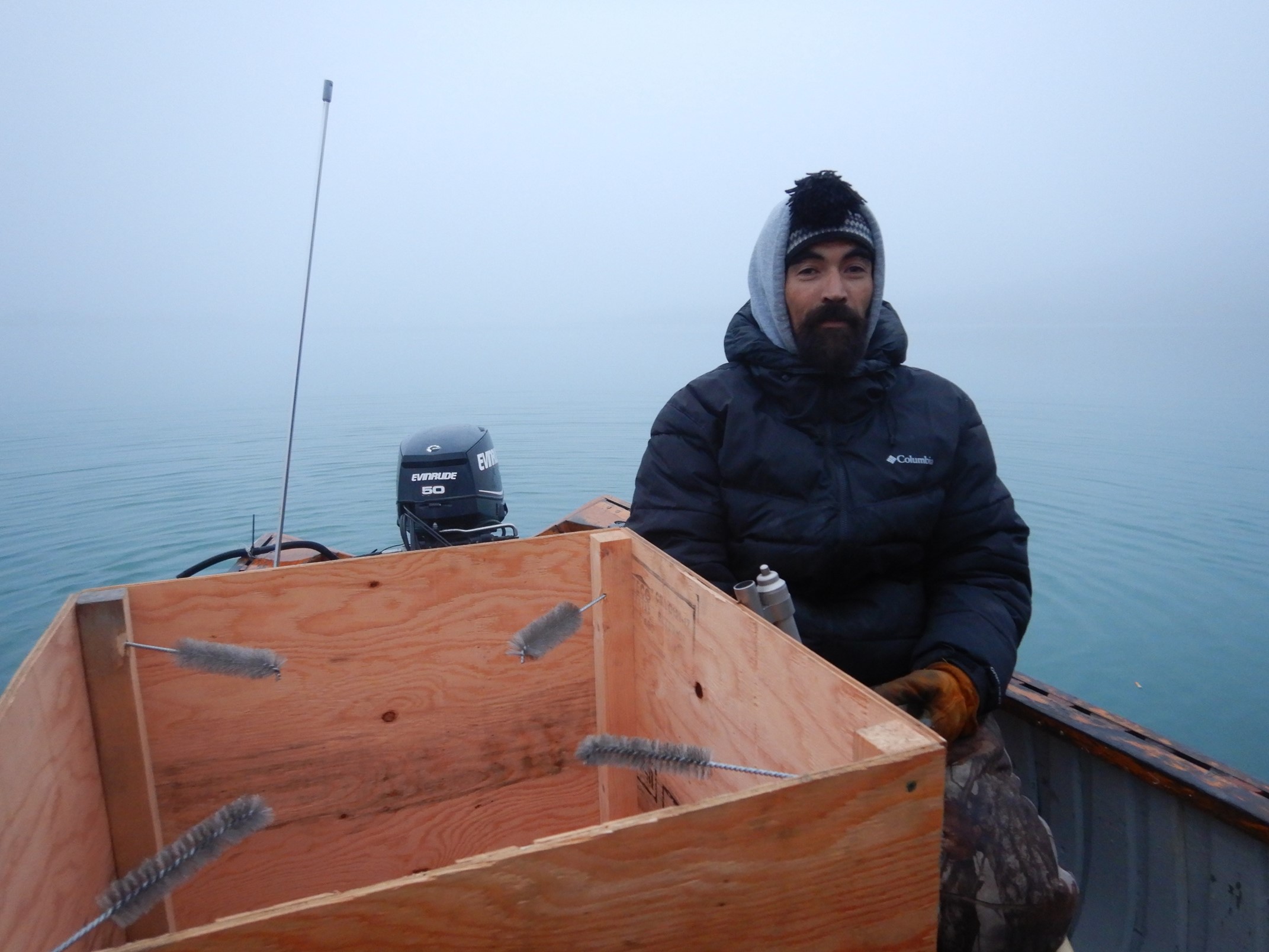
Hair traps like this are used to collect hair from polar bears, the DNA from which can be used to identify individual bears.
Credit: Arqvilliit IPCA Monitoring Crew.
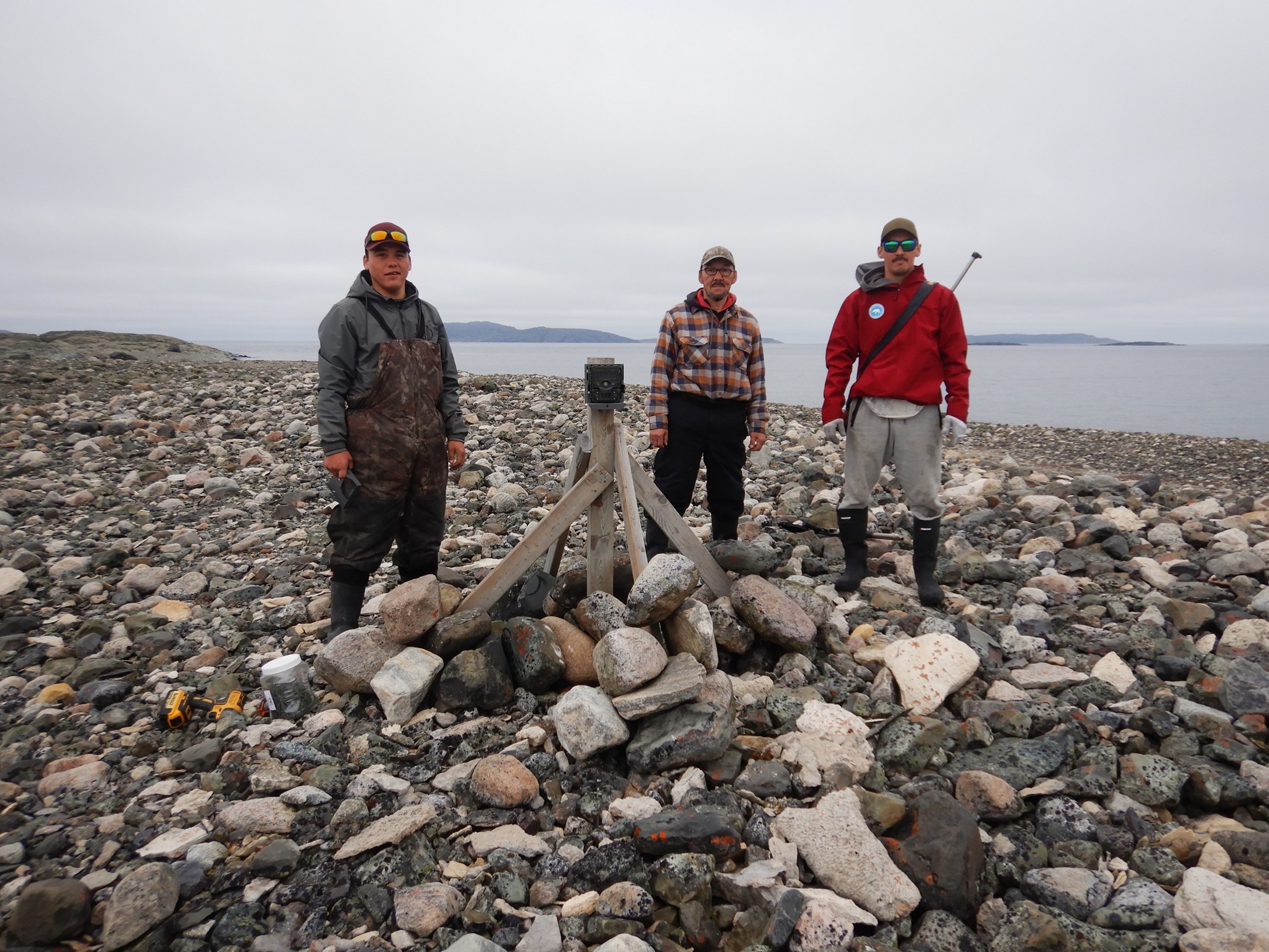
The Arqvilliit IPCA Monitoring Crew with one of the trail cameras set up to capture images of polar bears.
Credit: Arqvilliit IPCA Monitoring Crew.
Last year, four crew members and the project coordinator for the Arqvilliit IPCA Establishment Project departed Inukjuak on the Arvik, a 35-foot boat, for a five-day monitoring trip. The 2021 field season was mostly exploratory: the team gathered baseline data about the islands, collected information on target species such as polar bears and eider ducks, and started to catalogue the biodiversity of the islands. This work included the monitoring of polar bear presence and population genetics, conducting boat-based surveys of the islands, observing biodiversity and mapping habitat.
This year, with the help of the Pristine Seas team, more hair traps will be set up, drones will be used to survey the lands, diving teams will conduct underwater surveys, and boat-based surveys will allow for the deployment of remotely operated vehicles to survey the near-shore seafloor. Baited cameras and drop cameras will also be used in deeper marine areas between islands to see what lies below. The monitoring work will help everyone understand more about the marine environment of Arqvilliit, and the documentary will help amplify the voices of Inukjuak community leaders and Nunavimmiut about their vision and efforts toward Inuit-led marine protections and stewardship in Nunavik.
Follow along with the expedition on Instagram, Facebook and Twitter, and stay tuned for more! You can also read up on the previous legs of the expedition in Nunatsiavut, Western Hudson Bay, and James Bay.
Related Content
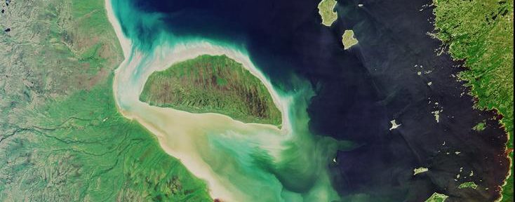
A satellite image of James Bay in summer.
Credit: NASA/JPL-Caltech.
Pristine Seas Expedition: James Bay
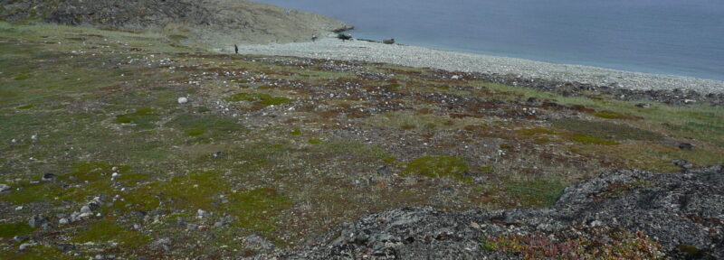
An Inuit-led archaeological team arrive arrive by boat to explore one of the islands in Arqvilliit.
Credit: Yvan Pouliot
Federal Government Pledges Support for Arqvilliit Indigenous Protected and Conserved Area

The largest summering population of beluga whales is found in Hudson Bay.
Credit: Oceans North
Pristine Seas Expedition: The Beluga Estuaries of Western Hudson Bay
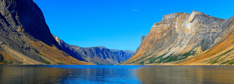
The Torngat Mountains in Nunatsiavut.
Credit: Tony Beck/Getty Images