Oceans North primarily works in the four Inuit land claim regions that make up Inuit Nunangat: Nunatsiavut, Nunavik, Nunavut and the Inuvialuit Settlement Region. We have also begun to work with northern First Nations groups.
Working with Communities
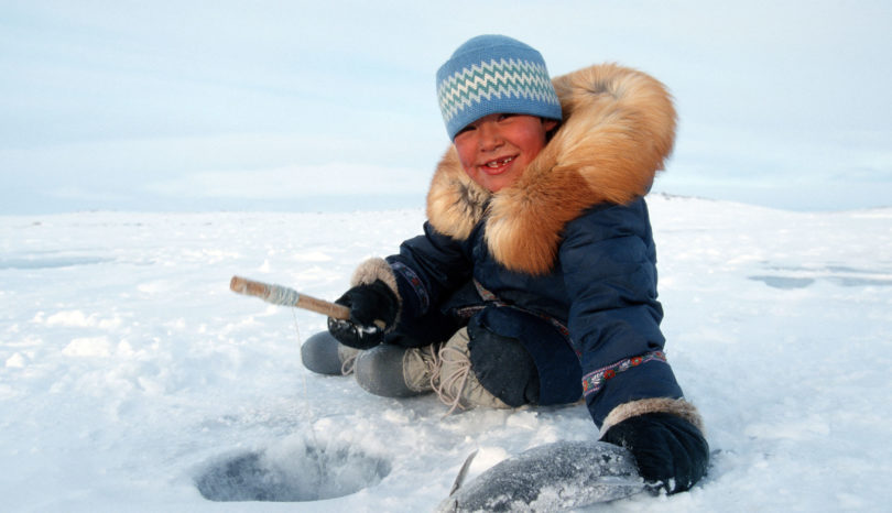
Oceans North puts a premium on community-driven research and local management. That means taking time to establish local partnerships and recognizing Indigenous interests in cultural, social, spiritual, physical and economic well-being. We aim for outcomes that serve both the environment and the broader needs of Arctic peoples.
What Is Nunangat?
Inuit Nunangat is an Inuktitut term meaning “homeland.” It is used to describe the four Inuit land claim regions and includes not just the land but also the water and ice. Inuit Nunangat covers more than a third of Canada’s land mass and half of its coastline.
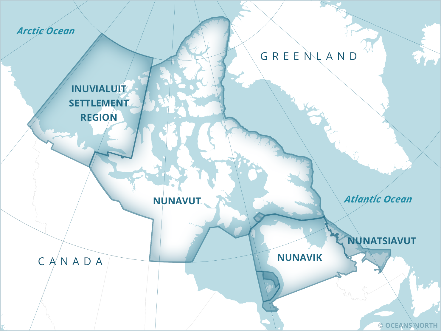
Nunatsiavut
Nunatsiavut is in eastern Canada, along the coast of northern Labrador, and is home to five communities, none of which are accessible by road.
The land claims negotiation process began in Nunatsiavut in 1977 when the Labrador Inuit Association (LIA) filed a statement of claim with the Government of Canada. Negotiations carried on through the 1980s and 1990s until the Inuit of Nunatsiavut, the Province of Newfoundland and Labrador and the Government of Canada signed the Labrador Inuit Land Claims Agreement in January 2005.
The resulting Labrador Inuit Settlement Area (LISA) includes large stretches of land and water:
- Approximately 73,000 square kilometres of land along the northeastern coast of Labrador
- About 49,000 square kilometres of marine area that extends beyond the coastline
- The Labrador Inuit Lands, totaling about 16,000 square kilometres (Labrador Inuit have title to these)
- The Torngat Mountains National Park, established with the LIA, in the northern tip of Labrador
When the land claims agreement and the Labrador Inuit Constitution took effect in December 2005, Nunatsiavut became the first Inuit region to achieve self-government. Today, the Nunatsiavut government is responsible for natural resource management and the delivery of health, education and cultural services. Its department of Lands and Natural Resources takes part in several co-management boards focused on the environment, conservation and planning. This includes the Torngat Mountains National Park Co-Management Board, which can advise on the management of the national park.
Nunavik
Nunavik lies north of the 55th latitude in the province of Quebec. It is home to over 12,000 people in 14 communities. Two land claims agreements cover the terrestrial and marine components of the region, including local agencies’ control of social, governmental and legal services.
The James Bay and Northern Quebec Land Claims Agreement (JBNQA) was signed in 1975 and was the first modern comprehensive land claim agreement signed in Canada’s North. The JBNQA defines indigenous territorial rights both north and south of the 55th parallel, establishing land categories, harvesting rights and resource management plans for the Inuit, Cree and Naskapi.
The Nunavik Inuit Land Claims Agreement (NILCA) took effect in 2007 and established their offshore rights in what is called the Nunavik Marine Region (NMR). This includes surface and subsurface rights to islands in the NMR.
The land claims agreement also established the Regional Nunavimmi Umajulivijiit Katujiqatigininga (RNUK), a regional association of hunters, fishermen and trappers that is made up of representatives from each community’s Local Nunavimmi Umajulivijiit Katujiqatigininga (LNUK). This group is responsible for all wildlife matters associated with the NMR.
The land claims agreement also established several management and planning boards.
Nunavut
Nunavut covers almost one-fifth of Canada’s landmass, from the 60th parallel north to the 82nd. The Nunavut Land Claims Agreement (NLCA), the largest land claim in Canadian history, was ratified in 1993, the same year that the Nunavut Act was signed. These agreements paved the way for the creation of the new territory of Nunavut on April 1, 1999.
The land claims agreement covers the Nunavut Settlement Area (NSA), which includes water, extending 12 miles out from the coastline, and land. Nunavut Tunngavik Incorporated (NTI), established in 1993, ensures that funds promised in the agreement are distributed and that all signatories fulfill their obligations, including maintaining the NSA’s boundary.
Nunavut has regional conservation bodies, sub-regional groups and community leaders:
A network of institutions in Nunavut play a role in conservation. There are five Institutions of Public Government (IPGs) and one nongovernmental organization composed of representatives from each of the IPGs.
Nunavut is divided into three smaller regions, each with its own Inuit association:
- Kitikmeot Inuit Association
- Qikiqtani Inuit Association
- Kivalliq Inuit Association
Finally, at a local level, there are Hunters and Trappers Organizations/Associations in each community.
Inuvialuit Settlement Region
The Inuvialuit Settlement Region (ISR) is the most western Inuit region and home to six communities that are found on both the mainland and Banks and Victoria islands in the Canadian Arctic Archipelago.
The Inuvialuit Final Agreement (IFA) was settled in 1984, giving the Inuvialuit people surface and subsurface rights to the region. The IFA established the Inuvialuit Regional Corporation to administer the lands and funds allocated in the agreement and to legally represent the Inuvialuit of the ISR. Each community has its own individual corporations.
The IFA also established a co-management system made up Inuvialuit organizations and co-management boards. The co-management boards include representatives from both the Inuvialuit Game Council, which consists of one member from each community’s Hunters and Trappers Committee (HTC), and officials from national and provincial government agencies.